Quadrion AI/Drone inspection & survey

Four dimensions.One view.

Drone video, 3D models, point clouds, maps and issues, fused into one georeferenced scene with one timeline. Fully offline, on your own machine.

01/The Quarter

Four dimensions. Four real assets.

  • XEasting

    Tank terminal

    757,579 captured points

    Photogrammetry cloud + engineering model

  • YNorthing

    Storage tank interior

    280,000 LiDAR points · 2 cm

    LiDAR scan + model + findings

  • ZElevation

    Flare stack, 80 m

    78 mapped corrosion patches

    Textured model + corrosion mapping

  • TTime

    Stockpile yard

    2 surveys · 10 days apart

    Two survey dates + volumes

x, y, z + time  =  one georeferenced scene

02/Tank terminal · photogrammetry

Every assettype.

757,579captured points
2.1 km × 1.0 kmsite extent
8storage tanks + jetty

03/Storage tank interior · LiDAR

Insidethe tank.

280,000LiDAR points · 2 cm
6graded findings, with photos
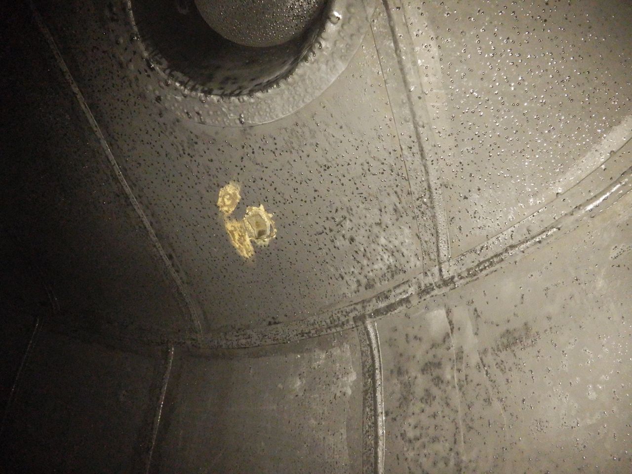
Patch damage on the tank roof plate
Severity 4 · Patch damageTop plate patch damageF02 · Roof · 8.48 m
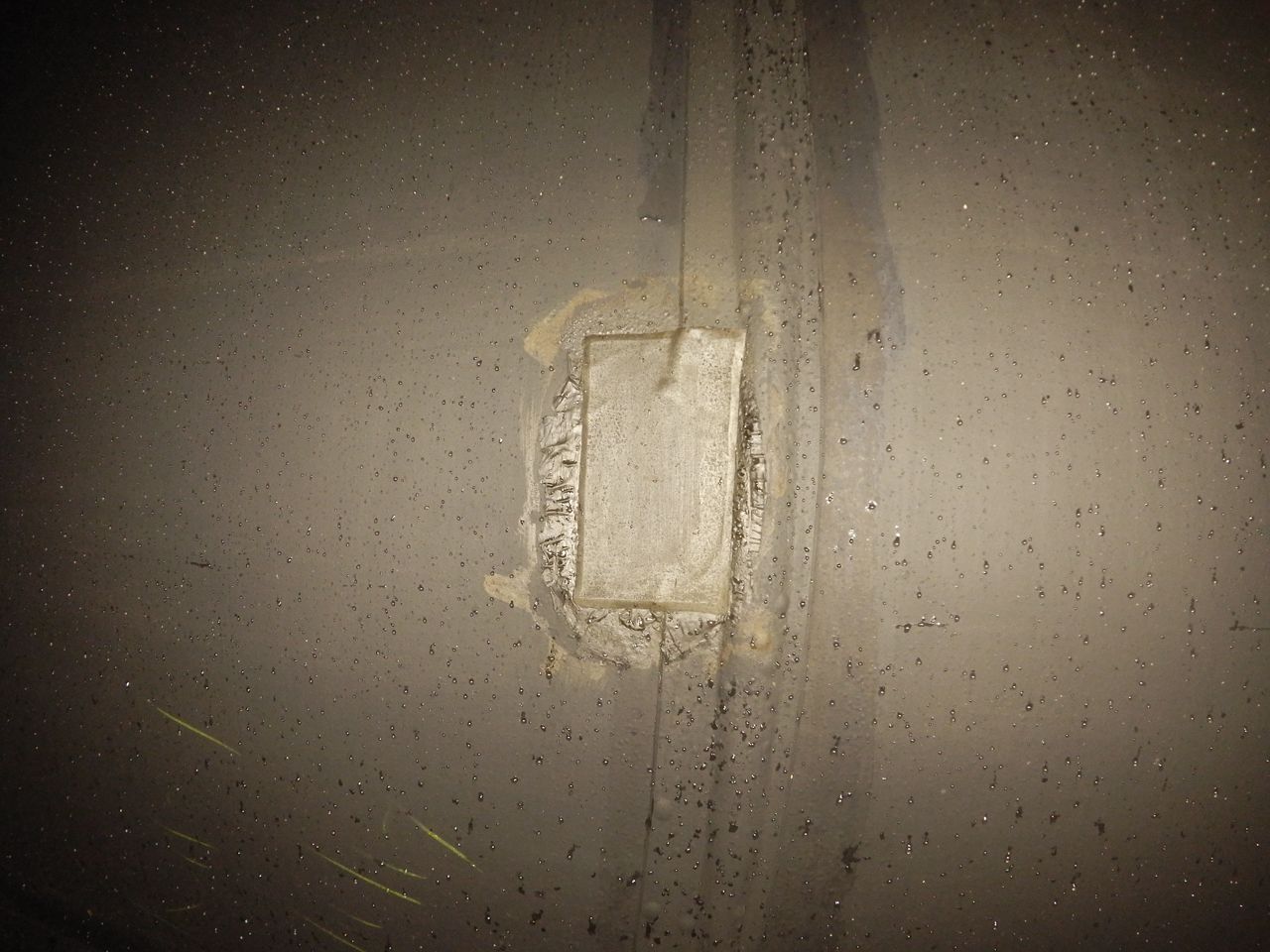
Coating blister on a vertical shell joint
Severity 3 · BlisterVertical joint, 3 o'clockF09 · Shell · 4.74 m
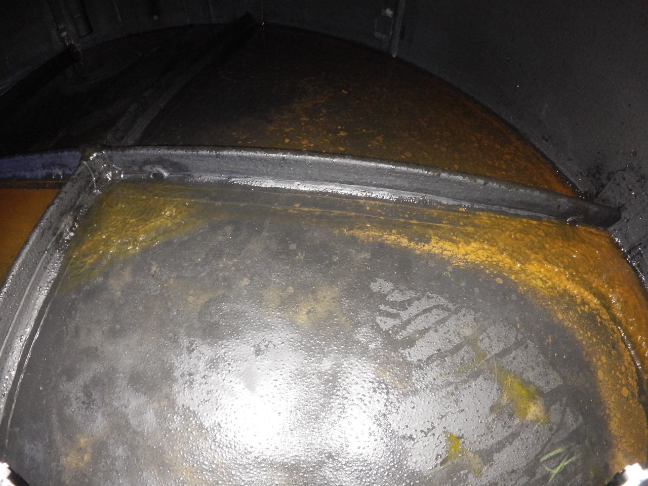
Crack in the bottom plate of the storage tank
Severity 5 · CrackCrack in bottom plateF01 · Bottom plate · 0.04 m

04/Flare stack, 80 m · textured model

Up thestack.

80 mscanned top to bottom
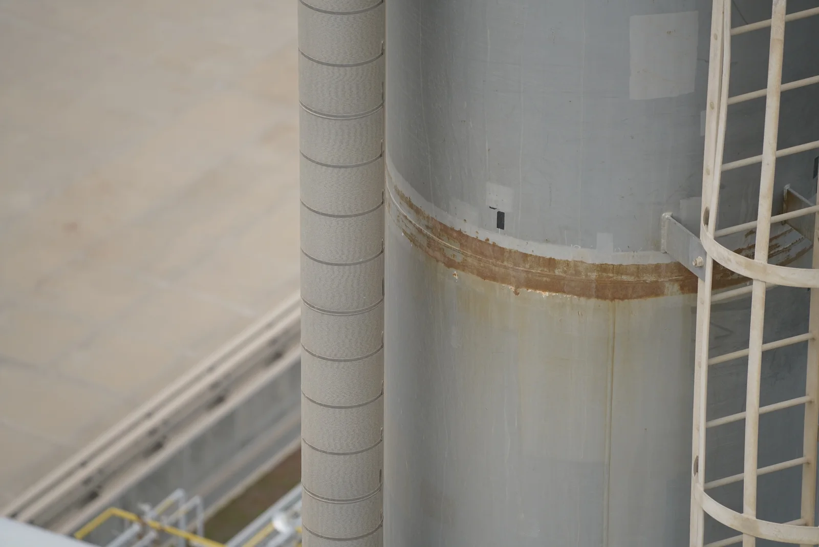
78mapped corrosion patches
41on the flare head
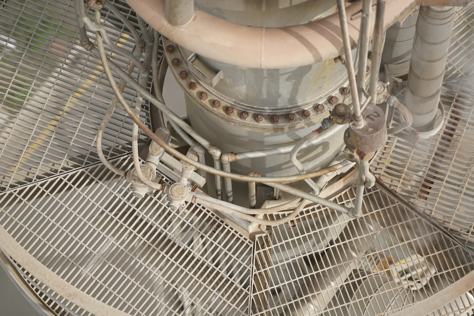
Moderate rust on the flare neck bolted connection
Moderate visible rustFlare neck / bolted connectionF04 · Flare head · 76.7 m
Moderate rust along a stack cladding seam
Moderate visible rustStack cladding / seamF44 · Stack / access · 55.3 m

05/Stockpile yard · two surveys

Acrosstime.

76,199m³Survey 1
63,402m³Survey 2, 10 days later
−12,797m³Net change · 19 piles
P0214,687 m³11,379 m³
P057,496 m³4,825 m³
P181,314 m³215 m³

06/In one place

Video, models, point clouds, maps and issues. Finally in one place. Offline.

No cloud uploadNo accountYour disks

07/The product

One view.

The same real datasets, live in the app. Pick a dataset on the left, inspect the scene, and every finding sits on the right with its photo.

Quadrion AI — GCC inspection programme — Scene
SceneIssuesVolumesReports Offline AI agent · own key
Flare stack, 80 mLive WebGL · real data
AI agent your key · off by default

Where is the corrosion on this stack?

41 of 78 patches sit on the flare neck and its bolted connection. The rest are on cladding seams and the base inlet.

Survey 1 Survey 2 +10 d Flights
  1. 01Real datasets
  2. 02Live 3D scene
  3. 03Findings with photos
  4. 04One timeline
  5. 05AI agent

08/Chapters

From flight
to handover.

Six chapters of the same job, on the same real data. Nothing leaves the machine between them.

Corrosion, mapped

Each drone photo is segmented into corrosion classes, then the mask is projected back onto the textured model as a patch you can measure.

  • Patches78
  • ZonesHead · Stack · Base
  • EvidencePhoto + class mask
F44 · Stack cladding / seam · 55.3 mMove to compare
Drone photo of a stack cladding seam with a band of rust
LightModerateHeavyUncertain

Every finding, located

Six graded findings inside one storage tank, each pinned in 3D on the LiDAR scan and backed by the photo it came from.

  • Findings6 with photos
  • Severity1 to 5
  • LocatedIn 3D, to the cm
Storage tank interior · findings06

Volumes, surface to surface

Two surveys ten days apart, 19 piles, cut and fill per pile. Hand the surfaces to Civil 3D, TBC or 12d when the engineers need them.

  • Piles19
  • MethodTriangulated toe
  • ExportsCivil 3D · TBC · 12d
Stockpile yard · Survey 1 → Survey 2−12,797 m³
76,199 m³Survey 1
63,402 m³Survey 2, 10 days later
Survey 1Survey 2CutFill

GPU processing

Optional NVIDIA GPU processing takes photo matching from minutes to seconds. The CPU path is always there.

  • HardwareNVIDIA, optional
  • StagePhoto matching
  • RunsOn your machine
20×

faster photo matching

CPU255 s
NVIDIA GPU12.9 s

255 s → 12.9 s  ·  same project, photo matching stage

An AI agent in every window

Ask about the project in plain language. It answers from your own data, with your own key and provider, and it is off until you turn it on.

  • DefaultOff
  • KeyYours
  • ScopeThis project
AI agentOwn key
Which tank findings need action first?
F01 photoF02 photo
How much did the stockpiles change?
Provider: your choiceCloud AI: off by default

Hand over the whole site

Export one read-only .aio package. Your client opens it in the free Player, offline, with cloud AI forbidden unless you allow it.

  • Package.aio
  • ViewerFree Player
  • Cloud AIOff by default
Export package.aio
.aio
handover.aioRead-only client package · 4 datasets
  • ├Tank terminal · photogrammetry cloud757,579 pts
  • ├Tank terminal · orthomosaic0.53 m / px
  • ├Storage tank interior · LiDAR280,000 pts · 6 findings
  • ├Flare stack, 80 m · textured mesh78 patches
  • └Stockpile yard · Survey 1 + Survey 219 piles
Read-onlyCloud AI forbiddenOpens offline in the free Player

09/Trust

Built for restricted networks.
Locked on, by design.

These are not settings you have to find. They are how Quadrion AI is built, for teams whose data never leaves the site.

AI agentAn AI agent sits in every window. It is off by default, and when you turn it on it uses your own key with the provider you choose.

Bring the whole site into one view.

See Quadrion AI on your own data, on your own network. Or send your client a read-only package and the free Player.

Windows desktop · Offline-first · Exports to Civil 3D, TBC and 12d

Direction D2 · The Quarter